
The French Broad River at Rankin, my favorite piece of water on Douglas Lake
I was scheduled to run on my area #9 which is Leadvale to Rankin on the French Broad. The water is too shallow to float so I headed out in the truck for the Rankin boat ramp well before sun-up. It was totally dark when I arrived. There was someone fishing at the end of the ramp. I could see the lighted end of his cigar moving to and from his mouth. Big cherry red coal. I thought it prudent to just wait in the truck for the sun to light things up before I went walking up to a total stranger in the dark and asking him how the fishing was.
The Rankin section of the river has been documented on this blog many, many times. This sunrise is beautiful but don't let it fool you. This is the area where Douglas Lake puts on her finest clothing to impress folks. When the light is turned up, the low water reveals clothing made of burlap and a face only a mother could love.
Oh - the guy had been fishing for three hours and had caught seven catfish. Not bad. He was getting ready to quit when I addressed him. In a few short moments I was left standing alone watching the early morning sun rise above and reflect off the French Broad River. I stayed there for an hour and no one appeared. The Leadvale ramp was only about ten miles away by road so I took off for there.


I took the above two shots along Route 25E on the way to Walters Bridge and Leadvale. See what I mean when I say that Douglas Lake is pretty until the sun comes up and you can look around. That silo way out there would be a great spot to build a prison. Wouldn't even need walls around it. Escapees would sink to their wastes in mud and be held fast. All that brown area is covered with 15 feet of water through the Summer. Humans shouldn't be permitted that much power over nature.

Here she is! It's the gravel road that leads out onto a peninsula with a little boat ramp at the end. Beautiful brown oozing mud lines both sides of the road. Don't get no better than this. No sirree. Nope!
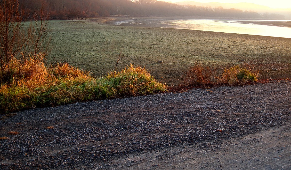
The above shot is the view to the left side of the road. All that mud with the "dead grass green" color is covered with 17 feet of water in the Summer. And at last I've reached Nirvana - the little boat ramp. Ain't she a sweetie?

Seriously speaking - look at this slime pit. The end of the concrete boat ramp is a trap consisting of very deep mud lying in wait to trap the wheels of some poor unsuspecting, uninformed, innocent angler out for a nice day. Four wheel drive won't even help on this ramp until that quick sand pool at the end of the ramp dries out. It looks like the water level is lower than last year by a lot. The situation above simply confirms my belief that this lake is a public nuisance.
Here's a pretty view of upstream from the Leadvale ramp.


Now, what you have to understand is that those rocks out there are as far as a boat can go upstream without a jet drive. Those rocks used to be bridge piers for a railroad bridge. They, TVA, seems to just knock structures down and leave the rubble laying in a pile to become a hazard. The shot below is a better view of the two rock piles. The one on the left is flattened fairly well but, the one on the right is sticking up very tall. Boats traverse over this mess all Summer and by Fall they go between them. In November they don't go.

Below is a view downstream from the ramp and under the newer railroad bridge that replaced the one that stood on these destroyed piers. Look how shallow the water is between the piers. Boats are expected to launch here. That water is about six inches deep at the ramp. Look at the rocks sticking out of the water.

This water is exceptional for holding walleye, sauger, striped bass, crappie and bluegill. The problem is getting to them. Anglers usually fish from the shorelines during the Winter months around these parts and they do well.

The above picture is a view across the river from the boat ramp. You can see that high brown, dirt wall. That plateau is normally covered with ten to fifteen feet of water all Summer. Even photos don't drive home the devastation caused by lowering the lake to this degree. It's one ugly duckling. It's only saving grace is that it has the finest bird habitat in East Tennessee at Rankin Bottoms on the French Broad River. It also holds one of the largest bald eagle populations in the East. For those reasons I'm going to miss it. I can always make trips here in my own boat when I like.
I ran back and forth from boat ramp to boat ramp for almost the whole morning and collected data as well as I could from dry land. A quick trip to the TWRA office in Morristown to dump off reports and I was done. I wanted to put my boat on Cherokee Lake and look for eagles. Cherokee Lake is so very close to Douglas Lake that I thought for sure I'd find bald eagles.
I went home, packed Shade up and took off for Cherokee.

The wind picked up strength when we got to the boat ramp. Had it been blowing this hard I probably wouldn't have come. I wanted to cruise along the shore for a few miles to see if I could scare up an eagle or two. We were at the Granger County Park boat ramp - one of my favorites.


This would be a rough ride at any speed over ten miles per hour. We would take it easy. Cherokee is a sprawling lake where Douglas is very narrow in comparison.

The coves were protected from the wind and the ride was nice. Out here though it was one rough cruise. We had driven about an hour and a half along really great eagle habitat and didn't see one eagle. I noted the difference in the shorelines of Cherokee and Douglas Lakes. Douglas is famous for it's pristine, Italian Rivera, mud shoreline and Cherokee is well known for the beautiful rock infested, stone quarry, moon surface like shoreline. Both are about as attractive as a two headed black snake at a beauty contest. I seem to remember back to last Summer how diminished the wildlife was on Cherokee. So far today I saw two crows and they were heading inland. And still no eagles.


Ah - at last I've found the trademark of Cherokee Lake. These rocks are actually mountain tops . The water depth is 111 feet here. Just over there about a hundred yards is a treacherous hazard lying in wait for an unsuspecting out of state boater who doesn't know this lake. And, still no eagles. I was ready to cross the lake and head back on the other side.


The wind is really picking up now. This was a really nice way to end an afternoon. Can't beat a boat ride especially when there is an ulterior motive - finding eagles. We traveled a total of about 14 miles round trip and didn't see an eagle. The lakes, Douglas and Cherokee are only a few miles apart and yet the eagles all gather on one of them only, Douglas, it seems. I'll have all Summer to document any eagles on Cherokee and if they are here - I'll find them as I'll cover every cove and section of shoreline on the lake. I won't, however, forsake the Douglas Lake eagles. I've collected a lot of data over the past two months and I want to follow through with it until nests are repaired or built, young are born and eagles migrate away or stay to become residents. I've forwarded the data to AEF (American Eagle Foundation) and want them to have the data right up through March and into April. The Gheenoe will be getting a workout in 2013.

I allowed my sarcastic streak to emerge in this entry just a little. Hope you didn't mind. Most of the snide comments are made in jest. I do that at times. Both of these lakes have their strong points at their upper ends on river sections. Those areas contain most of the wildlife habitat. As a matter of fact the Holston River that flows into Cherokee Lake is the river that Beech Creek enters above the John Sevier Fossil Fuel Plant. That's mighty sweet up there. It will be an interesting Summer.
Tomorrow I'm off and may go to the elk range to do a head count and photograph some elk. I'll see what the morning looks like tomorrow. Can't plan to early. See you tomorrow with more wild country, outdoor activities of interest.
Some interesting scenic shots,mud and all.I am sure you realize that without human intervention those lakes would not exist,TN.has only 1 natural lake.And without the flood control dams and the draw down to accommodate winter runoff the pre existing streams would often turn into raging floods causing loss of life and property.The hydro electric dams do double duty by providing inexpensive electric service to people that were denied it before they were built.I too like nature in its natural state but somtimes we have to tolerate things for the greater good.
ReplyDeleteI actually deleted the comment I had posted as I sometimes lump Alcoa and TVA together in the same vein. TVA was commissioned in 1933 by the Feds to create flood control and hydroelectric power. As time progressed they seemed to expand their endeavors to other areas as they grew and grew, to include some profitable land sales to out of state as well as local realtors - land that was unnecessary to the installation of all the dams. It is overage, so to speak. That being said there are 8 hydroelectric dams on the Little Tennessee River alone which dammed up the entire river system. Yes, I agree that flood control was necessary and the dams brought power to rural East Tennessee. But - It doesn't take 8 hydroelectric dams to feed East Tennessee.The Feds subsidized the dams and their success and growth was guaranteed as the products they produce (electric) is in very high demand by everyone. The eventual marketing of hydroelectric power made TVA an individual Goliath in the industry. So - 8 dams on the Little T.- Santeelah, Acoe, Cheoah, Calderwood, Tellico (a TVA dam not needed at all but used for lake side property sales) Ft. Loudon, Melton Hill culminating at Watts Bar Lake. Santeelah, Acoe, Cheoah and Calderwood were Alcoa Dams but power was shared (sold) to TVA who had control of the water flow but no the electric produced until years later. Then you have Cherokee and Douglas for flood control --and that much "needed" resource of electric power. The point is that all that power is not needed in East Tennessee and all the dams on that one river destroyed the Agricultural heritage in the valley. What started as necessity continued and was fueled by greed. TVA still has no competition even today and never will. But, the Little T is ruined and a lot of folks lost their property to make the dams. Dams are a good thing when used in moderation and limited to necessity. Taxation on hydroelectric power by the government ,kick back to the Feds annually by TVA and an endless source of money is why the dams are still in place.
Deletehttp://en.wikipedia.org/wiki/Tennessee_Valley_Authority
As a a continuation on the little rant above I made: Point is that it's wonderful to make hydroelectric power for the local folks and really a magnificent accomplishment to bring revenue into the state through the sale of electric power but - not at the expense of the citizens who had their properties taken against their will through that great instrument of justice known as eminent domain. Then to have the Government (TVA) sell the unnecessary tracts of acquired property to real estate developers at a hefty profit is unconscionable! That's my gripe.
DeleteBravo Gary, you spelled the true explaination out in total. So many people do not have a clue as to what happened when the lakes were built. My family (father) was so distraught because of the many friends and family's that lost their land and home. Probably the only time I ever saw him trying to cover up tears when I asked him about what was going to happen when the"lake came". I was frighten to see my Dad so sad. I listened as he told my bother John and Mom some of what was going to happen didn't need to happen in the large scale. I never knew his meaning until years later. My family's close friends lost all they had and work for to establish as their purchased land holding. We all wanted to preserve the natural areas, even in those times. Every family and land holder understood and respected what the land and animals gave back and "life rewarding benefits". They didn't hunt if they didn't meat for their families and they didn't hunt or fish unless they needed the food. Times were hard and families did what the could. Trust me they did not litter the earth as we do today. I was always taught to take care of our land. Anne
ReplyDelete