A narrow peninsula, roadway, exists where those cars are parked all the way to the old concrete bridge pier you see on the left side of the picture. The water is so high that it has completely covered everything from the road behind the cars to that concrete pier. This is Douglas Reservoir at Leadvale. It really is the French Broad River, but is considered Douglas Lake. There is a lot of silt and water flowing down the French Broad and the muddy inflow from the Pigeon and Nolichucky Rivers adds fuel to the fire, so to speak. The Nolichucky River is just upstream about two miles and that's where I headed today. I have not travelled up the Nolichucky very far due to the varying shallow depths normally encountered. I figured the river would have enough depth to allow the Gheenoe to go upstream for miles.
I turned into the mouth of the Nolichucky and was on my way. The waterway narrowed down fairly quickly. I'm not really familiar with the Nolichucky above the flood control dam located off Route 350 at the Davy Crockett Reservoir. The Nolichucky flows down through Green, Cocke and Hamblin Counties and joins the French Broad River between Leadvale and Rankin, Tennessee. It is a wild, white water river North of Davy Crockett Lake. Enormous vertical rock cliffs contain the Nolichucky for much of its path. The water is tamed as it flows through Green, Cocke and Hamblen Counties and often times is a very slow moving body of water. That is one of nature's tricks to fool the foolish. That would be us humans. It is a treacherous piece of water even when appearing docile.
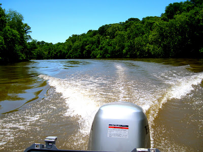
That is really muddy water. The foliage was heavy on both sides of the water and the river had overflowed its banks and flooded the land for hundreds of yards inland.
This river lacks interesting landscapes. It is, for the most part wild with very few houses along its banks, but it becomes boring after a half hour of looking at the same unending terrain. It goes on and on and on. The shorelines are solid, vivid green with no sign of flowers or boulders.
This river doesn't hold a candle to the beauty of the Holston River, especially at the John Sevier Steam Plant at Beech Creek. A sandpiper chased tiny insects over the rocks to my right.
He is a spotted sandpiper
I actually saw a bald eagle pass over the boat. I documented the grids and will document the sighting.
The scenery appeared the same for mile after mile. I would have turned around here except for the desire I had to see how far I could get upstream. At last - wildlife. I heard an osprey chirping frantically at my intrusion. They give their position away when they do that.
He was straight ahead of the boat and he had eyes on me. Their stare is intense when they set eyes on ya.
Yikes! - A second one came out of the dense tree line and startled me.
Well now - that was a delightful addition to the morning. I continued to an auto bridge spanning the river. The water depth suddenly dropped to four feet. I was ready to turn around.
I spun the boat around and headed back downstream.
The trip up this river was a delightful change from the normal. I learned something about the waterway and am now aware of the width and depth of the river. This is not a place I would head for to enjoy an afternoon. It's a dull stretch of water.
Now, I had to thread my way back downstream to the French Broad and on down that waterway past Leadvale to Walter's Bridge where I put the boat in the water. This was a totally uneventful morning. Sometimes that's a good thing. Tomorrow is a holiday and I have off, but am scheduled on paper to be on the Holston. I might just go to work. See ya later and enjoy your holiday.


No comments :
Post a Comment
I appreciate your interest in my blog and welcome your comments